
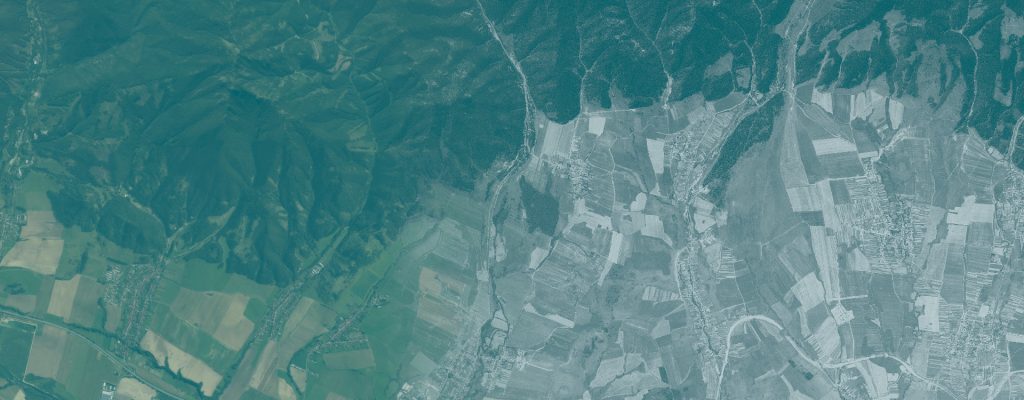
The RETROCHANGE project provides public access to historical KH-9 satellite imagery and supporting geospatial datasets through ArcGIS REST and OGC Web Map Services (WMS).
These services allow users to visualize historical satellite imagery, integrate it with other geospatial data, and explore the High Tatras and Poloniny–Bieszczady study areas using desktop GIS software and web mapping applications.
The services include dynamically rendered imagery, cached map layers optimized for different coordinate reference systems, and supporting vector layers representing map-sheet grids, national park boundaries, and use-case areas of interest.
Service Access
All services are hosted by the Technical University in Zvolen within the RETROCHANGE project.
Two interfaces are available:
- ArcGIS REST Services: Native ArcGIS map services for integration with ArcGIS Pro, web applications, and other GIS clients.
- OGC Web Map Services (WMS): Standardized map services supporting visualization and integration with OGC-compatible GIS applications, including QGIS and ArcGIS Pro.
ArcGIS REST Services Directory: https://maps.tuzvo.sk/ags/rest/services/retrochange
High Tatras
Historical KH-9 satellite imagery from 1975 covering the High Tatras study area in Slovakia and Poland, together with supporting reference layers.
| Service | Description | WMS |
|---|---|---|
| htatras_1975 | Dynamically rendered historical KH-9 imagery. Source CRS: EPSG:5514. | https://maps.tuzvo.sk/ags/services/retrochange/htatras_1975/MapServer/WMSServer? |
| htatras_epsg3857 | Cached imagery optimized for web mapping. CRS: EPSG:3857 (Web Mercator). | https://maps.tuzvo.sk/ags/services/retrochange/htatras_epsg3857/MapServer/WMSServer? |
| htatras_epsg5514 | Cached imagery in S-JTSK / Krovak East North. CRS: EPSG:5514. | https://maps.tuzvo.sk/ags/services/retrochange/htatras_epsg5514/MapServer/WMSServer? |
| htatras_map_sheets | Map-sheet grid at a nominal scale of 1:5,000 (2.5 × 2.0 km tiles), used for imagery mosaicking and GeoTIFF distribution. | https://maps.tuzvo.sk/ags/services/retrochange/htatras_map_sheets/MapServer/WMSServer? |
| htatras_np | Generalized boundaries of national parks in the High Tatras region. | https://maps.tuzvo.sk/ags/services/retrochange/htatras_np/MapServer/WMSServer? |
| htatras_uc1 | Areas of interest used for RETROCHANGE use-case development, validation, and testing. | https://maps.tuzvo.sk/ags/services/retrochange/htatras_uc1/MapServer/WMSServer? |
Poloniny–Bieszczady
Historical KH-9 satellite imagery from 1975 covering the Poloniny–Bieszczady cross-border study area, together with supporting reference layers.
| Service | Description | WMS |
|---|---|---|
| poloniny_1975 | Dynamically rendered historical KH-9 imagery. Source CRS: EPSG:5514. | https://maps.tuzvo.sk/ags/services/retrochange/poloniny_1975/MapServer/WMSServer? |
| poloniny_epsg3857 | Cached imagery optimized for web mapping. CRS: EPSG:3857 (Web Mercator). | https://maps.tuzvo.sk/ags/services/retrochange/poloniny_epsg3587/MapServer/WMSServer? |
| poloniny_epsg5514 | Cached imagery in S-JTSK / Krovak East North. CRS: EPSG:5514. | https://maps.tuzvo.sk/ags/services/retrochange/poloniny_epsg5514/MapServer/WMSServer? |
| poloniny_map_sheets | Map-sheet grid at a nominal scale of 1:5,000 (2.5 × 2.0 km tiles), used for imagery mosaicking and GeoTIFF distribution. | https://maps.tuzvo.sk/ags/services/retrochange/poloniny_map_sheets/MapServer/WMSServer? |
| poloniny_np | Generalized boundaries of national parks in the Poloniny–Bieszczady region. | https://maps.tuzvo.sk/ags/services/retrochange/poloniny_np/MapServer/WMSServer? |
| poloniny_uc2 | Areas of interest used for RETROCHANGE use-case development, validation, and testing. | https://maps.tuzvo.sk/ags/services/retrochange/poloniny_uc2/MapServer/WMSServer? |
Connecting to the Services
ArcGIS Pro: Open Insert → Connections → Server and create an ArcGIS Server or WMS connection using the corresponding service URL.
QGIS: Open Data Source Manager → WMS/WMTS → New, enter the WMS URL, and connect to the available layers.
For technical information about the available layers, supported coordinate reference systems, and geographic extents, use the REST service description or WMS GetCapabilities document.
For WMS, a GetCapabilities request can be generated by appending ?SERVICE=WMS&REQUEST=GetCapabilities&VERSION=1.3.0 to the WMS service URL.
Data Sources and Usage
Original imagery: Declassified KH-9 (HEXAGON) satellite imagery courtesy of the U.S. Geological Survey (USGS), Earth Resources Observation and Science (EROS) Center.
Georeferencing, mosaicking, and service preparation: Technical University in Zvolen, RETROCHANGE project.
The RETROCHANGE-derived imagery datasets are provided under Creative Commons Attribution 4.0 International (CC BY 4.0) to the extent of the rights held by the Technical University in Zvolen. Refer to the individual dataset metadata for attribution and usage information.
The generalized boundaries and other supporting reference layers are intended for visualization and research context and should not be treated as authoritative legal or cadastral boundaries.
Project website: https://gis.tuzvo.sk/retrochange
Interactive Web Map: https://maps.tuzvo.sk/retrochange/