Czech University of Life Sciences Prague
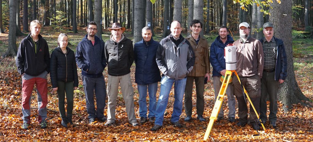
The Department of Forest Management at the Faculty of Forestry and Wood Sciences belongs to the leader research institutions in the topic of utilizing unmanned aerial vehicles (UAVs) together with photogrammetry methods in forestry for purposes of forest inventory and monitoring. The research group has experiences with photogrammetric data acquisition as well as data processing, creating ortophoto maps and 3D point clouds. Recently in ongoing projects the members are developing methodologies for optimizing flight parameters in relation to camera positions and angles in order to ensure maximal quality of the products, and also algorithms for interpretation of the photogrammetry products, like 3D point clouds and ortophoto maps.
- Peter Surovy, associate professor
- Karel Kuzelka, researcher
- Dimitrios Panagiotidis, researcher
- Azadeh Abdollahnejad, Ph.D. student
- Jakub Martinisko, Ph.D. student
Technical University Vienna
The Photogrammetry group of the Department of Geodesy and Geoinformation at Technical University Vienna has expertise in modeling the measurement process for airborne laser scanning and image matching. This allows calibration and orientation of the sensor data and derivation of primary models with accuracy at the nominal sensor accuracy. These primary models are point clouds and topographic surfaces. The expertise reaches, however, further to automated interpretation of the scenes, especially in the fields of forestry (forest border, biomass), but also in the fields of water and geomorphology. The research group Photogrammetry seeks close cooperation with scientific partners from neighboring disciplines (geomorphology, forestry, ecology) in order to enable comprehensive exploitation of Earth observation technology for relevant questions in society.
- Norbert Pfeifer, professor
- Markus Hollaus, senior scientist
- Di Wang, Ph.D. student
- Martin Wieser, Ph.D. student
- Wilfried Karel, Ph.D. student
- Livia Piermattei, PostDoc
Technical University in Zvolen
The Laboratory of geoinformatics of the Department of Forest Management and Geodesy at the Faculty of Forestry, Technical University in Zvolen has expertise in forest mapping, photogrammetry, laser scanning, geographical data acquisition and processing for purposes of forest inventory and modelling.
- Milan Koreň, associate professor
- Martin Mokroš, researcher
- Julián Tomaštík, lecturer/researcher
- Marek Fabrika, associate professor
- Juraj Čerňava, Ph.D. student
- Martin Zápotocký, Ph.D. student
The project involves a number of young researchers and Ph.D. students, which will significantly help to the successful completion of the project and the achievement of all objectives of the project. Involvement of young researchers and Ph.D. students in the whole process of the project is a crucial aspect of sustainability and progress of proposed research. At the same time, they bring to the project their know-how in the form of mentioned prototypes and algorithms that are fundamental to the proposed project.